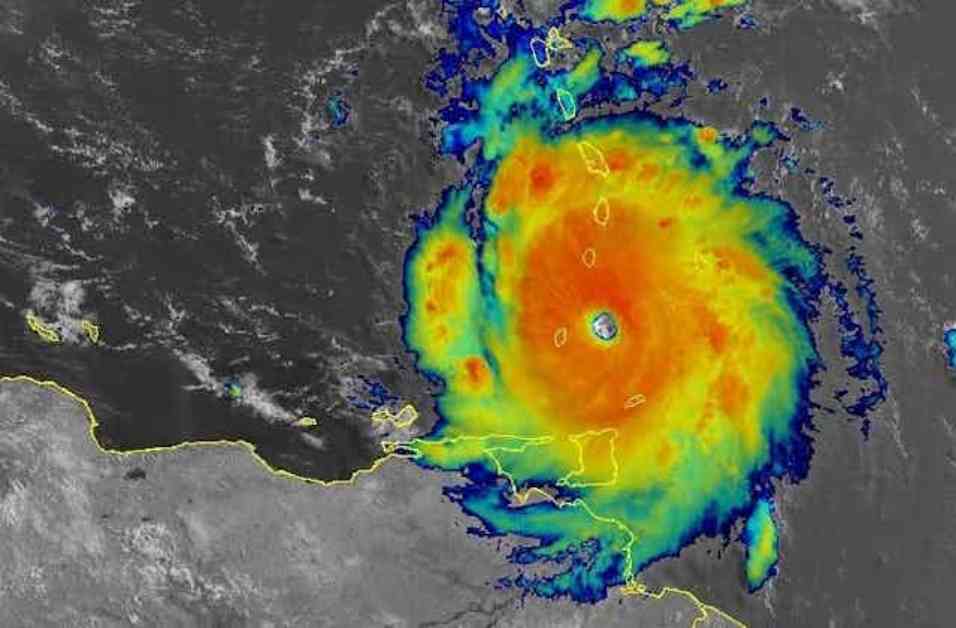
Hurricane Beryl quickly intensified into a powerful Category 5 storm, causing widespread damage in the Grenadine Islands. The Prime Minister of Grenada described the devastation as “extensive,” particularly on Carriacou and Petite Martinique.
This rapid intensification of Beryl was unusual for a storm so early in the hurricane season. Experts are concerned about the implications of such powerful storms occurring at the beginning of what is predicted to be an active Atlantic hurricane season.
One key factor in the rapid intensification of hurricanes is warm ocean water. The ocean heat content leading up to Hurricane Beryl was exceptionally high, providing the storm with the energy it needed to strengthen quickly. In addition to warm water, other environmental factors such as low vertical wind shear and a moist atmosphere play a role in rapid intensification.
Research suggests that as ocean temperatures rise due to climate change, rapid intensification events may become more common. Data shows that the peak intensification rates of hurricanes have increased over the years, resulting in more storms like Hurricane Beryl.
The good news is that advancements in hurricane prediction models are helping forecasters better predict rapid intensification events. New technologies like the Hurricane Analysis and Forecast System and artificial intelligence are providing more tools to improve hurricane forecasts and give communities more time to prepare for potential threats.
Overall, the intensification of Hurricane Beryl serves as a reminder of the importance of understanding and monitoring the factors that contribute to rapid intensification in order to better prepare for future storms.


